Aktiv logg: 2024-01-12 16:05
- Distance: 6.0 Km
- Elevation gain: 91 m
- Maximum elevation: 61 m
- Elevation loss: 90 m
- Minimum elevation: 32 m
- Moving time: 17 m 19 s
- Moving speed: 20.7 Km/h
- Maximum speed: 51.9 Km/h
- Total time: 2 h 14 m
- Global speed: 2.7 Km/h
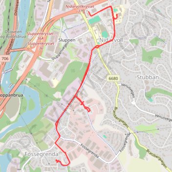
Interactive trail map
Trail profile
- Distance: 6.0 Km
- Elevation gain: 91 m
- Maximum elevation: 61 m
- Elevation loss: 90 m
- Minimum elevation: 32 m
- Moving time: 17 m 19 s
- Moving speed: 20.7 Km/h
- Maximum speed: 51.9 Km/h
- Total time: 2 h 14 m
- Global speed: 2.7 Km/h
About this trail
Name: Aktiv logg: 2024-01-12 16:05 trail, distance, elevation, map, profile, GPS track
Coordinates: 63.38653 10.39654 63.40172 10.40980