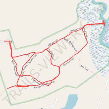
Latham-Whitehurst Nature Park Trails
- Distance: 3.9 Km
- Elevation gain: 5 m
- Maximum elevation: 5 m
- Elevation loss: 5 m
- Minimum elevation: 1 m
- Moving time: 1 h 5 m
- Moving speed: 3.6 Km/h
- Maximum speed: 6.5 Km/h
- Total time: 1 h 26 m
- Global speed: 2.7 Km/h
Interactive trail map
Trail profile
- Distance: 3.9 Km
- Elevation gain: 5 m
- Maximum elevation: 5 m
- Elevation loss: 5 m
- Minimum elevation: 1 m
- Moving time: 1 h 5 m
- Moving speed: 3.6 Km/h
- Maximum speed: 6.5 Km/h
- Total time: 1 h 26 m
- Global speed: 2.7 Km/h
About this trail
Name: Latham-Whitehurst Nature Park Trails trail, distance, elevation, map, profile, GPS track
Start: Yellow Trail, Craven County, North Carolina, United States (35.11554 -76.95089)
End: Yellow Trail, Craven County, North Carolina, United States (35.11543 -76.95046)
Coordinates: 35.11209 -76.95089 35.11705 -76.94201
Other hiking, mountain biking, running and outdoor activity trails
Click on a trail to view its statistics, map and profile.
Latham-Whitehurst Nature Park
United States > North Carolina > Craven County
Distance: 4.6 Km • Elevation gain: 4 m • Maximum elevation: 6 m