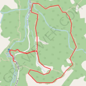
Hoggs Falls
Duncan Escarpment Provincial Park. #Hiking #Loop #Hoggs #DuncanEscarpment
- Distance: 5.3 Km
- Elevation gain: 121 m
- Maximum elevation: 431 m
- Elevation loss: 121 m
- Minimum elevation: 356 m
Interactive trail map
Trail profile
- Distance: 5.3 Km
- Elevation gain: 121 m
- Maximum elevation: 431 m
- Elevation loss: 121 m
- Minimum elevation: 356 m
About this trail
Name: Hoggs Falls trail, distance, elevation, map, profile, GPS track
Coordinates: 44.28239 -80.54394 44.29317 -80.53133
Topography: Grey Highlands topographic map, elevation, terrain
Other hiking, mountain biking, running and outdoor activity trails
Click on a trail to view its statistics, map and profile.
Owen Sound - Orangeville
Canada > Ontario > Grey County > Owen Sound
Distance: 107.6 Km • Elevation gain: 593 m • Maximum elevation: 517 m