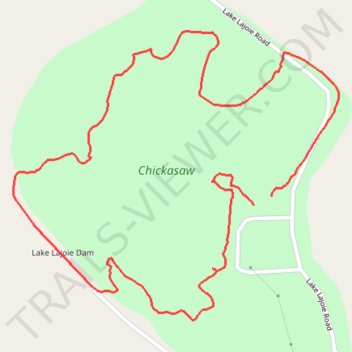
Lake Lajoie Loop Trail
- Distance: 3.1 Km
- Elevation gain: 52 m
- Maximum elevation: 148 m
- Elevation loss: 55 m
- Minimum elevation: 132 m
- Moving time: 54 m 44 s
- Moving speed: 3.4 Km/h
- Maximum speed: 7.8 Km/h
- Total time: 56 m 8 s
- Global speed: 3.3 Km/h
Interactive trail map
Trail profile
- Distance: 3.1 Km
- Elevation gain: 52 m
- Maximum elevation: 148 m
- Elevation loss: 55 m
- Minimum elevation: 132 m
- Moving time: 54 m 44 s
- Moving speed: 3.4 Km/h
- Maximum speed: 7.8 Km/h
- Total time: 56 m 8 s
- Global speed: 3.3 Km/h
About this trail
Name: Lake Lajoie Loop Trail trail, distance, elevation, map, profile, GPS track
Start: Hardeman County, West Tennessee, Tennessee, United States (35.34661 -88.88201)
End: Hardeman County, West Tennessee, Tennessee, United States (35.34642 -88.88249)
Coordinates: 35.34392 -88.88887 35.35017 -88.88023
Other hiking, mountain biking, running and outdoor activity trails
Click on a trail to view its statistics, map and profile.
Gmaps Pedometer Route
United States > Kentucky > Fulton County > Hickman
Distance: 502.9 Km • Elevation gain: 4,204 m • Maximum elevation: 592 m