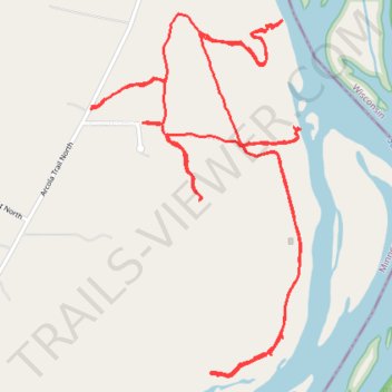
Trails north of Stillwater along Saint Croix River
- Distance: 7.1 Km
- Elevation gain: 160 m
- Maximum elevation: 274 m
- Elevation loss: 160 m
- Minimum elevation: 211 m
- Moving time: 57 m 48 s
- Moving speed: 7.3 Km/h
- Maximum speed: 15.7 Km/h
- Total time: 1 h 7 m
- Global speed: 6.3 Km/h
Interactive trail map
Trail profile
- Distance: 7.1 Km
- Elevation gain: 160 m
- Maximum elevation: 274 m
- Elevation loss: 160 m
- Minimum elevation: 211 m
- Moving time: 57 m 48 s
- Moving speed: 7.3 Km/h
- Maximum speed: 15.7 Km/h
- Total time: 1 h 7 m
- Global speed: 6.3 Km/h
About this trail
Name: Trails north of Stillwater along Saint Croix River trail, distance, elevation, map, profile, GPS track
Coordinates: 45.11049 -92.75446 45.12233 -92.74475