Olallie and Talapus Lakes Trail in Mount Baker Snoqualmie National Forest
The Olallie and Talapus Lakes Trail in Mount Baker-Snoqualmie National Forest offers hikers a serene journey through lush forests, culminating in the tranquil waters of Talapus and Olallie Lakes. The well-maintained path winds through towering cedars and hemlocks, providing a cool, shaded canopy. Upon reaching the lakes, visitors can enjoy picturesque views, with Talapus Lake nestled near Bandera Mountain and Olallie Lake framed by Pratt Mountain and Tusk O’Granite. #Hiking #Mountain #Forest #Nature #Lake
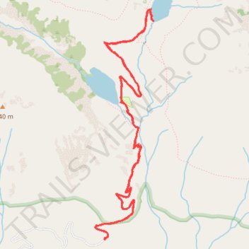
- Distance: 9.5 Km
- Elevation gain: 421 m
- Maximum elevation: 1,174 m
- Elevation loss: 420 m
- Minimum elevation: 788 m
- Moving time: 2 h 3 m
- Moving speed: 4.6 Km/h
- Maximum speed: 7.4 Km/h
- Total time: 2 h 10 m
- Global speed: 4.4 Km/h
Interactive trail map
Trail profile
- Distance: 9.5 Km
- Elevation gain: 421 m
- Maximum elevation: 1,174 m
- Elevation loss: 420 m
- Minimum elevation: 788 m
- Moving time: 2 h 3 m
- Moving speed: 4.6 Km/h
- Maximum speed: 7.4 Km/h
- Total time: 2 h 10 m
- Global speed: 4.4 Km/h
About this trail
Name: Olallie and Talapus Lakes Trail in Mount Baker Snoqualmie National Forest trail, distance, elevation, map, profile, GPS track
Coordinates: 47.40115 -121.51966 47.42204 -121.51178
Other hiking, mountain biking, running and outdoor activity trails
Click on a trail to view its statistics, map and profile.
Northern part of the Pacific Crest Trail (PCT)
United States > Oregon > Klamath County
Hike on the Pacific Crest National Scenic Trail from Crater Lake to Canada Border through Oregon and Washington along the Sierra Nevada and Cascade mountain ranges. #Hiking #Mountain #SierraNevada #Cascade #Nature #Forest #Park #PCT
Distance: 1,198.3 Km • Elevation gain: 44,308 m • Maximum elevation: 2,307 m
Talapus Lake Trailhead to Pratt Lake via Talapus Lake and Olallie Lake
United States > Washington > King County
Distance: 17.8 Km • Elevation gain: 769 m • Maximum elevation: 1,262 m