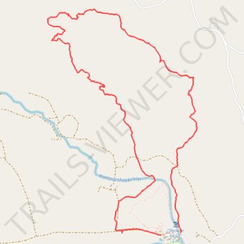
Gifboom Loop Trail
- Distance: 7.8 Km
- Elevation gain: 267 m
- Maximum elevation: 535 m
- Elevation loss: 260 m
- Minimum elevation: 342 m
- Moving time: 3 h 5 m
- Moving speed: 2.5 Km/h
- Maximum speed: 10.0 Km/h
- Total time: 5 h 6 m
- Global speed: 1.5 Km/h
Interactive trail map
Trail profile
- Distance: 7.8 Km
- Elevation gain: 267 m
- Maximum elevation: 535 m
- Elevation loss: 260 m
- Minimum elevation: 342 m
- Moving time: 3 h 5 m
- Moving speed: 2.5 Km/h
- Maximum speed: 10.0 Km/h
- Total time: 5 h 6 m
- Global speed: 1.5 Km/h
About this trail
Name: Gifboom Loop Trail trail, distance, elevation, map, profile, GPS track
Coordinates: -31.80918 18.77104 -31.78998 18.78606