Ha Ling Peak
Bow Valley Wildland Provincial Park. #Hiking #Snowshoeing #BowValley
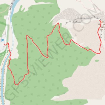
- Distance: 7.8 Km
- Elevation gain: 817 m
- Maximum elevation: 2,473 m
- Elevation loss: 817 m
- Minimum elevation: 1,667 m
Interactive trail map
Trail profile
- Distance: 7.8 Km
- Elevation gain: 817 m
- Maximum elevation: 2,473 m
- Elevation loss: 817 m
- Minimum elevation: 1,667 m
About this trail
Name: Ha Ling Peak trail, distance, elevation, map, profile, GPS track
Coordinates: 51.05667 -115.41819 51.06446 -115.39964
Topography: Kananaskis Improvement District topographic map, elevation, terrain
Other hiking, mountain biking, running and outdoor activity trails
Click on a trail to view its statistics, map and profile.