Mara Hill
Interactive trail map
Trail profile
About this trail
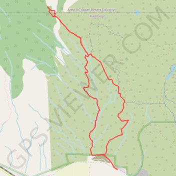
Name: Mara Hill trail, distance, elevation, map, profile, GPS track
Coordinates: 50.71720 -120.45848 50.74380 -120.43762
Topography: Kamloops topographic map, elevation, terrain
Other hiking, mountain biking, running and outdoor activity trails
Click on a trail to view its statistics, map and profile.
Cache Creek - Kamloops
Canada > British Columbia > Thompson-Nicola Regional District > Cache Creek
Distance: 86.9 Km • Elevation gain: 1,114 m • Maximum elevation: 736 m