Import a GPX file

Wetaskiwin, Alberta, Canada trails

Click on a trail to view its statistics, map and profile.
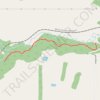
Chickadee Trail

Canada > Alberta > County of Wetaskiwin

File with points/tracks from Locus Map/4.35.0

Distance: 1.8 Km • Elevation gain: 52 m • Maximum elevation: 728 m

Gear up for your next adventure:

☕Camping Coffee Maker - Brew fresh coffee anywhere on the topographic map
🧭GPS Outdoor Watch - Smart watch for navigation and fitness tracking in nature
🔭Compact Monocular - One-handed bird watching and trail spotting
🧢Sun Protection Cap - Breathable cap to protect from sun exposure
🥫Freeze-Dried Meals - Lightweight, high-calorie nutrition for multi-day treks

As an Amazon Associate, this site earns from qualifying purchases at no extra cost to you.