Import a GPX file

Loopview trails

Click on a trail to view its statistics, map and profile.

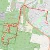
Redland - Bayview Conservation Area

Australia > Queensland > Point Talburpin

#MTB #Loopview

Distance: 17.4 Km • Elevation gain: 253 m • Maximum elevation: 75 m

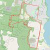
Redland - Bayview Conservation Area

Australia > Queensland > Point Talburpin

#MTB #Loopview

Distance: 21.1 Km • Elevation gain: 240 m • Maximum elevation: 76 m

Bayview Conservation Area

Australia > Queensland

#MTB #Loopview

Distance: 36.9 Km • Elevation gain: 371 m • Maximum elevation: 75 m

Gear up for your next adventure:

🔋Emergency Crank Radio - Weather alerts and power without needing batteries
🥾Trail Hiking Socks - Comfortable socks to prevent blisters and fatigue
🔦LED Flashlight - Powerful and long-lasting flashlight for camping and emergencies
☕Camping Coffee Maker - Brew fresh coffee anywhere on the topographic map
🚲MTB Frame Bag - Carry tools and maps directly on your bicycle frame

As an Amazon Associate, this site earns from qualifying purchases at no extra cost to you.