Import a GPX file

LeJeune trails

Click on a trail to view its statistics, map and profile.

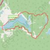
Le Jeune Lake

Canada > British Columbia > Thompson-Nicola Regional District > Area J (Copper Desert Country)

#Hiking #Loop #LeJeune

Distance: 12.5 Km • Elevation gain: 149 m • Maximum elevation: 1,314 m

Gear up for your next adventure:

🥫Freeze-Dried Meals - Lightweight, high-calorie nutrition for multi-day treks
🔋Solar Power Bank - Keep your GPS and devices charged during long outdoor trips
🧥Packable Rain Jacket - Breathable waterproof layer for unpredictable weather
🥾Trail Running Boots - Durable shoes designed for trail running
🔭Compact Monocular - One-handed bird watching and trail spotting

As an Amazon Associate, this site earns from qualifying purchases at no extra cost to you.