Emerald Lake Emerald Basin trails
Click on a trail to view its statistics, map and profile.
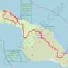
Trans Catalina Trail (TCT)
United States > California > Los Angeles County > Avalon > Pebbly Beach
The Trans-Catalina Trail begins in Avalon, leaving the island’s lively harbor town to climb into the dry, rugged interior of Santa Catalina Island. The route passes Haypress Reservoir and Cape Canyon Reservoir before entering the Black Jack backcountry and continuing toward Catalina Airport, often known as…
Distance: 62.3 Km • Elevation gain: 2,826 m • Maximum elevation: 531 m
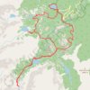
Bear Lake to Timberline Falls Loop
United States > Colorado > Larimer County
Starting at Bear Lake in Rocky Mountain National Park’s Bear Lake Road Corridor, this loop briefly follows the shore before climbing onto the Emerald Lake Trail toward Nymph Lake and Dream Lake. The traced route then leaves the direct Emerald Lake approach, turns toward Chaos Creek, and reaches the rocky…
Distance: 15.6 Km • Elevation gain: 712 m • Maximum elevation: 3,281 m