
Division No. 8, Manitoba, Canada trails
Click on a trail to view its statistics, map and profile.
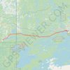
Whiteshell - Kenora
Canada > Unorganized Division No. 1
#Bike #Whiteshell #Kenora
Distance: 69.2 Km • Elevation gain: 577 m • Maximum elevation: 382 m
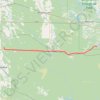
Richer - Whiteshell
Canada > Rural Municipality of Ste. Anne > Richer
#Bike #Richer #Whiteshell
Distance: 88.6 Km • Elevation gain: 126 m • Maximum elevation: 340 m

Whiteshell Provincial Park - Pine Point Trail
Canada > Unorganized Division No. 1
Distance: 8.8 Km • Elevation gain: 129 m • Maximum elevation: 320 m