Import a GPX file

Borumba trails

Click on a trail to view its statistics, map and profile.
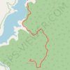
Borumba Dam - Mount Borumba

Australia > Queensland

Lake Borumba. Imbil State Forest. #Hiking #Borumba #Imbil

Distance: 6.2 Km • Elevation gain: 575 m • Maximum elevation: 603 m

Ochre Falls

Australia > Queensland

Distance: 4.8 Km • Elevation gain: 229 m • Maximum elevation: 514 m

Gear up for your next adventure:

🔨Vehicle Emergency Tool - Safety tool for remote road trips to trailheads
🛌Down Sleeping Bag - Superior warmth-to-weight ratio for cold nights
☕Camping Coffee Maker - Brew fresh coffee anywhere on the topographic map
💧Hydration Pack - Hands-free hydration system for long hikes
🛶Kayak Dry Bag - Waterproof storage for kayaking adventures

As an Amazon Associate, this site earns from qualifying purchases at no extra cost to you.