Import a GPX file

Big Bear San Bernardino National Forest trails

Click on a trail to view its statistics, map and profile.
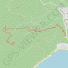
Bertha Peak

United States > California > San Bernardino County

Hike from Big Bear Lake to Bertha Peak via Cougar Crest Trail, Pacific Crest National Scenic Trail (PCT) and Bertha Peak Road in the San Bernardino National Forest. #Hiking #Nature #Lake #Mountain #Forest #PCT

Distance: 5.7 Km • Elevation gain: 437 m • Maximum elevation: 2,487 m

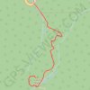
Grays Peak

United States > California > San Bernardino County > Fawnskin

Hike from Big Bear Lake to Grays Peak in the San Bernardino National Forest. #Hiking #Mountain #Lake #Forest #Nature

Distance: 5.6 Km • Elevation gain: 373 m • Maximum elevation: 2,410 m

Castle Rock

United States > California > San Bernardino County > Big Bear Lake

Hike to the Castle Rock from Big Bear Lake along the Castle Rock Creek in the San Bernardino National Forest. #Hiking #Mountain #Forest #River #Lake #Nature

Distance: 1.2 Km • Elevation gain: 161 m • Maximum elevation: 2,254 m

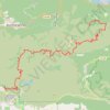
Big Bear - San Bernardino National Forest

United States > California > San Bernardino County > Highland

Distance: 61.0 Km • Elevation gain: 3,536 m • Maximum elevation: 2,429 m
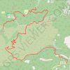
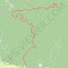
Big Bear - San Bernardino National Forest

United States > California > San Bernardino County

Distance: 37.2 Km • Elevation gain: 1,048 m • Maximum elevation: 2,413 m

Gear up for your next adventure:

💧Filtered Water Bottle - Safe drinking water on the go
⛺Camping Groundsheet - Protect your tent from moisture and dirt
🧢Beanie Hat - Keep your head warm in cold weather
🧦Merino Wool Socks - Moisture-wicking comfort for long-distance hiking
🌬️Windproof Camp Stove - Efficient cooking even on exposed mountain peaks

As an Amazon Associate, this site earns from qualifying purchases at no extra cost to you.