Import a GPX file

Bald Hills trails

Click on a trail to view its statistics, map and profile.
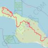
Trans Catalina Trail (TCT)

United States > California > Los Angeles County > Avalon > Pebbly Beach

The Trans-Catalina Trail begins in Avalon, leaving the island’s lively harbor town to climb into the dry, rugged interior of Santa Catalina Island. The route passes Haypress Reservoir and Cape Canyon Reservoir before entering the Black Jack backcountry and continuing toward Catalina Airport, often known as…

Distance: 62.3 Km • Elevation gain: 2,826 m • Maximum elevation: 531 m
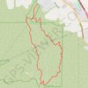
Bane Canyon Loop

United States > California > San Bernardino County > Chino Hills

Beginning near the North Entrance off Sapphire Road, the loop briefly follows Bane Canyon Road into Chino Hills State Park before leaving the paved corridor for the East Fence Line Trail, where rolling grasslands, coastal sage scrub, spring wildflowers, and views across Bane Canyon and the nearby urban edge…

Distance: 12.2 Km • Elevation gain: 435 m • Maximum elevation: 357 m

Maligne Lake - Bald Hills

Canada > Alberta > Improvement District No. 12

Jasper National Park. #Hiking #Loop #Maligne #Jasper

Distance: 14.7 Km • Elevation gain: 728 m • Maximum elevation: 2,381 m

Bald Hills

Canada > Alberta > Improvement District No. 12

#Hiking #Loop

Distance: 9.1 Km • Elevation gain: 475 m • Maximum elevation: 2,171 m

Bald Hills - Bulimba Creek - Springwood

Australia > Queensland > City of Brisbane

#Bike #Loop #Brisbane

Distance: 107.2 Km • Elevation gain: 892 m • Maximum elevation: 90 m

Downfall Creek - Cabbage Tree Creek

Australia > Queensland > City of Brisbane

#Bike #MTB #Loop #Brisbane

Distance: 80.6 Km • Elevation gain: 464 m • Maximum elevation: 65 m

Dayboro - Mount Mee - Kobble Creek

Australia > Queensland > City of Brisbane

Lake Samsonvale. #Bike #Loop #Samsonvale #Mee #Kobble #Brisbane

Distance: 112.5 Km • Elevation gain: 1,817 m • Maximum elevation: 421 m

Bunyaville Conservation Park

Australia > Queensland > City of Brisbane

#MTB #Loop #Bunyaville

Distance: 47.9 Km • Elevation gain: 523 m • Maximum elevation: 106 m

Dayboro - Wamuran

Australia > Queensland > City of Brisbane

D'Aguilar National Park. #MTB #DAguilar

Distance: 84.6 Km • Elevation gain: 2,030 m • Maximum elevation: 541 m

Brisbane - Currimundi

Australia > Queensland > City of Brisbane

#MTB #Brisbane

Distance: 115.4 Km • Elevation gain: 445 m • Maximum elevation: 42 m

Lady Bird Grove Loop Trail

United States > California > Humboldt County

Distance: 2.5 Km • Elevation gain: 49 m • Maximum elevation: 420 m

Gear up for your next adventure:

👟Trail Running Shoes - Agile footwear for fast-paced topographic exploration
💡Solar Camping Lamp - Eco-friendly lighting for campsites
⛺Lightweight Camping Tent - Portable shelter optimized for Canadian backcountry camping
🔦UV Flashlight - Detect minerals or specific insects in the dark
📷Outdoor Action Camera - Capture high-elevation views and rugged adventures

As an Amazon Associate, this site earns from qualifying purchases at no extra cost to you.