
Swansea trails
Click on a trail to view its statistics, map and profile.

Gower National Landscape Day 3
United Kingdom > Wales > Swansea > Horton
Distance: 17.3 Km • Elevation gain: 354 m • Maximum elevation: 85 m
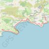
Gower National Landscape Day 2
United Kingdom > Wales > Swansea > Bishopston
Distance: 22.3 Km • Elevation gain: 552 m • Maximum elevation: 96 m

Gower National Landscape Day 5
United Kingdom > Wales > Swansea > Landimore
Distance: 20.7 Km • Elevation gain: 174 m • Maximum elevation: 59 m
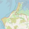
Gower National Landscape Day 4
United Kingdom > Wales > Swansea > Llangennith
Distance: 18.7 Km • Elevation gain: 254 m • Maximum elevation: 59 m

Llandimore Marsh
United Kingdom > Wales > Swansea > Landimore
Distance: 12.6 Km • Elevation gain: 221 m • Maximum elevation: 32 m