Import a GPX file

Willian trails

Click on a trail to view its statistics, map and profile.
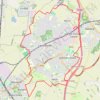
Letchworth Greenway

United Kingdom > England > Hertfordshire > North Hertfordshire > Willian

Route created on plotaroute.com

Distance: 20.5 Km • Elevation gain: 161 m • Maximum elevation: 108 m

Gear up for your next adventure:

💡Compact LED Flashlight - Powerful and portable flashlight for outdoor use
🌬️Windproof Camp Stove - Efficient cooking even on exposed mountain peaks
🥾Trail Hiking Socks - Comfortable socks to prevent blisters and fatigue
👖Convertible Hiking Pants - Zip-off legs to adapt to changing weather conditions
🧣Evaporative Cooling Towel - Beat the heat during intense summer climbs

As an Amazon Associate, this site earns from qualifying purchases at no extra cost to you.