
Tai Wai New Village trails
Click on a trail to view its statistics, map and profile.
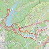
蝴蝶園坑 下城左坑
China > Hong Kong > Sha Tin District > Tai Wai New Village > Heung Fan Liu New Village
Distance: 14.2 Km • Elevation gain: 791 m • Maximum elevation: 253 m
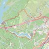
神秀左脊
China > Hong Kong > Sha Tin District > Tai Wai New Village
Distance: 9.1 Km • Elevation gain: 763 m • Maximum elevation: 487 m
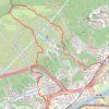
Hong Kong Trail Run - Shatin
China > Hong Kong > Sha Tin District > Tai Wai New Village
Distance: 6.9 Km • Elevation gain: 455 m • Maximum elevation: 412 m