Import a GPX file

Livingston trails

Click on a trail to view its statistics, map and profile.
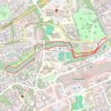
River Almond riverside paths

United Kingdom > Scotland > West Lothian > Livingston

Distance: 4.8 Km • Elevation gain: 34 m • Maximum elevation: 113 m
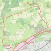
Beecraigs Hill Riccarton Hill Cairn

United Kingdom > Scotland > West Lothian > Livingston

Distance: 25.6 Km • Elevation gain: 376 m • Maximum elevation: 293 m

Gear up for your next adventure:

👖Convertible Hiking Pants - Zip-off legs to adapt to changing weather conditions
🧭GPS Tracker - Track your location in remote areas safely
🛁Quick-Dry Microfiber Towel - Space-saving towel that dries rapidly on the move
🕶️Polarized Sunglasses - Reduces glare from snow and water at high elevations
🥾Mountain Hiking Shoes - Shoes with superior grip for mountainous terrain

As an Amazon Associate, this site earns from qualifying purchases at no extra cost to you.