Import a GPX file

Church Stretton trails

Click on a trail to view its statistics, map and profile.
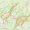
Longmynd Hike 50 miles

United Kingdom > England > Shropshire > Church Stretton > All Stretton

Distance: 77.8 Km • Elevation gain: 2,661 m • Maximum elevation: 527 m
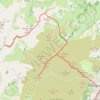
Church Stretton to Bridges

United Kingdom > England > Shropshire > Church Stretton

Distance: 15.4 Km • Elevation gain: 410 m • Maximum elevation: 512 m

Other places

Gear up for your next adventure:

🔋Emergency Crank Radio - Weather alerts and power without needing batteries
🧥Waterproof Jacket - Lightweight rain jackets for hiking and outdoor activities
🦶Hiking Shoe Insoles - Added support for high arches and long days on feet
🥾Waterproof Hiking Shoes - Durable shoes for wet and rugged trails
🧤Rechargeable Heated Gloves - Extreme warmth for Canadian winter expeditions

As an Amazon Associate, this site earns from qualifying purchases at no extra cost to you.