Import a GPX file

Pak Tam Au trails

Click on a trail to view its statistics, map and profile.
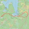
蚺蛇尖山下

China > Hong Kong > Tai Po District > Pak Tam Au

Distance: 10.3 Km • Elevation gain: 449 m • Maximum elevation: 237 m
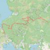
東牛耳石坑 牛耳石坑 畫眉坑 雷榕石澗 畫眉西右坑 隱龍右源

China > Hong Kong > Tai Po District > Pak Tam Au

Hong Kong Hike

Distance: 13.6 Km • Elevation gain: 1,165 m • Maximum elevation: 406 m

西贡蚺蛇尖

China > Hong Kong > Tai Po District > Pak Tam Au

Distance: 13.5 Km • Elevation gain: 822 m • Maximum elevation: 408 m

Gear up for your next adventure:

☕Camping Coffee Maker - Brew fresh coffee anywhere on the topographic map
🔋Lithium AA Batteries - Long-lasting power that performs in extreme cold
🔦LED Headlamp - Hands-free lighting for early morning starts or late finishes
🕯️Camping Lantern - Illuminates your entire campsite with high-efficiency LEDs
🧢Hiking Hat - Sun-protective and breathable hats for long treks

As an Amazon Associate, this site earns from qualifying purchases at no extra cost to you.