Import a GPX file

Greenock trails

Click on a trail to view its statistics, map and profile.
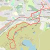
Dunrod Hill and Hillside Hill loop from Greenock West - Clyde Muirshiel Regional Park

United Kingdom > Scotland > Inverclyde > Greenock

Distance: 18.9 Km • Elevation gain: 410 m • Maximum elevation: 291 m

Gear up for your next adventure:

🧥Ultralight Puffy Jacket - Maximum warmth that packs down to the size of an orange
🚲Handlebar Phone Mount - View topographic-map.com live while cycling
Tent Footprint - Protect tent floor and increase durability
🚑Survival Whistle - Signal for help across long distances in mountains
🥾Hiking Gaiters - Protect legs and shoes from mud, snow, and debris

As an Amazon Associate, this site earns from qualifying purchases at no extra cost to you.