Import a GPX file

Beauharnois-Salaberry trails

Click on a trail to view its statistics, map and profile.
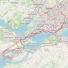
Salaberry-de-Valleyfield - Montréal

Canada > Quebec > Beauharnois-Salaberry > Salaberry-de-Valleyfield

#Bike

Distance: 89.9 Km • Elevation gain: 363 m • Maximum elevation: 70 m

Other places

Gear up for your next adventure:

💡Compact LED Flashlight - Powerful and portable flashlight for outdoor use
🔋Solar Power Bank - Keep your GPS and devices charged during long outdoor trips
🧦Merino Wool Socks - Moisture-wicking comfort for long-distance hiking
💧Filtered Water Bottle - Safe drinking water on the go
🔭Compact Monocular - One-handed bird watching and trail spotting

As an Amazon Associate, this site earns from qualifying purchases at no extra cost to you.