Import a GPX file

Le Cornet trails

Click on a trail to view its statistics, map and profile.
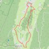
B12 A la découverte des deux villages, départ Autr

France > Auvergne-Rhône-Alpes > Isère > Autrans-Méaudre en Vercors > Autrans > Le Cornet

Distance: 16.2 Km • Elevation gain: 344 m • Maximum elevation: 1,193 m

Gear up for your next adventure:

🧴Bear Spray Holster - Quick-access carry for essential Canadian wilderness safety
Bushcraft Tarp - Versatile emergency shelter or gear protection
Camping Coffee Maker - Brew fresh coffee anywhere on the topographic map
🥾Trail Running Boots - Durable shoes designed for trail running
🥾Trekking Boots - Durable boots for long-distance trekking

As an Amazon Associate, this site earns from qualifying purchases at no extra cost to you.