
Wellington County trails
Click on a trail to view its statistics, map and profile.

Guelph Lake Conservation Area Loop Trails
Canada > Ontario > Wellington County > Guelph/Eramosa
Distance: 6.3 Km • Elevation gain: 64 m • Maximum elevation: 373 m

Fletchers Creek Ecological Preserve Loop
Canada > Ontario > Wellington County > Puslinch
Fletchers Creek Ecological Preserve. #Hiking #Running #Loop #FletchersCreek
Distance: 4.7 Km • Elevation gain: 19 m • Maximum elevation: 296 m
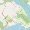
Guelph Lake Conservation Area Loop
Canada > Ontario > Wellington County > Guelph/Eramosa
Distance: 6.3 Km • Elevation gain: 65 m • Maximum elevation: 372 m

Elora Gorge hiking & exploring
Canada > Ontario > Wellington County > Centre Wellington > Elora
Distance: 8.3 Km • Elevation gain: 106 m • Maximum elevation: 387 m