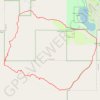
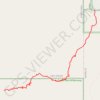
Click on a trail to view its statistics, map and profile.
United States > California > Riverside County > La Quinta
Loop hike in the Santa Rosa Wilderness from the Cove Oasis via Boo Hoff Trail, Devil Canyon and Lake Cahuilla. #Hiking #Loop #Mountain #Wilderness #Nature #Canyon #Lake
Distance: 20.0 Km • Elevation gain: 712 m • Maximum elevation: 577 m
Loop hike from Lake Cahuilla Park to Cove Oasis via Boo Hoff Trail in the Santa Rosa Wilderness. #Hiking #Loop #Lake #Nature #Mountain #Wilderness #Desert
Distance: 17.4 Km • Elevation gain: 673 m • Maximum elevation: 577 m
Hike from Cove Oasis to Bear Creek Oasis via the Bear Creek Trail in the Santa Rosa Wilderness. #Hiking #Oasis #Nature #Desert #Mountain #Wilderness
Distance: 7.0 Km • Elevation gain: 649 m • Maximum elevation: 702 m
As an Amazon Associate, this site earns from qualifying purchases at no extra cost to you.