
Bent Creek trails
Click on a trail to view its statistics, map and profile.
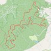
Pisgah National Forest Run Loop
United States > North Carolina > Buncombe County > Bent Creek
Loop run / trail / hike from Rice Pinnacle Parking via Wolf Branch Trail, Ingles Fields Gap, Little Hickory Top, Sidehill Trail, Greens Lick Trail, North Boundary Road, Wolf Knob, Mease Gap, Moors Gap, Corvair Trail and Deer Lake Road in the Pisgah National Forest. #Running #Trail #Hiking #Loop #Forest #Nature
Distance: 23.1 Km • Elevation gain: 907 m • Maximum elevation: 1,015 m