Import a GPX file

Municipality of Colchester trails

Click on a trail to view its statistics, map and profile.
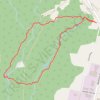
Mi'kmawey Debert Interpretive Trail

Canada > Nova Scotia > Municipality of Colchester > Debert

Distance: 4.5 Km • Elevation gain: 37 m • Maximum elevation: 33 m
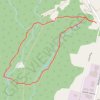
Mi'Kmawey Interpretive Trail

Canada > Nova Scotia > Municipality of Colchester > Debert

#Hiking #Running #Loop

Distance: 4.2 Km • Elevation gain: 30 m • Maximum elevation: 33 m

Sandy Cope Loop

Canada > Nova Scotia > Municipality of Colchester > Upper Kemptown

Loop hike via Yellow Birch Trail, Earlton Lake & Portage Trail, Sandy Cope Loop, Donald's Falls and Willard Kitchener MacDonald Trail in the Gully Lake Wilderness Area. #Hiking #Loop #Nature #Forest #Falls #Wilderness

Distance: 5.3 Km • Elevation gain: 105 m • Maximum elevation: 200 m

Brookfield - Halifax

Canada > Nova Scotia > Municipality of Colchester > Brookfield

#Bike #Brookfield #Halifax

Distance: 92.2 Km • Elevation gain: 658 m • Maximum elevation: 66 m

Other places

 •  •

Gear up for your next adventure:

🛶Kayak Accessories - Essential gear for safe and fun kayaking adventures
💧Hydration Pack - Hands-free hydration system for long hikes
🔭Compact Monocular - One-handed bird watching and trail spotting
🧢Sun Protection Cap - Breathable cap to protect from sun exposure
🧊Portable Cooler - Keep food and drinks cold during outdoor adventures

As an Amazon Associate, this site earns from qualifying purchases at no extra cost to you.