Import a GPX file

McDonald County trails

Click on a trail to view its statistics, map and profile.
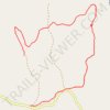
Huckleberry Ridge Conservation Area

United States > Missouri > McDonald County > Meadors Ford

Distance: 4.9 Km • Elevation gain: 118 m • Maximum elevation: 369 m
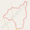
Huckleberry Ridge Conservation Area

United States > Missouri > McDonald County

Distance: 4.7 Km • Elevation gain: 107 m • Maximum elevation: 366 m

Other places

Gear up for your next adventure:

🧴Waterproofing Spray - Restore the DWR coating on jackets and tents
🧦Crew Hiking Socks - Comfortable socks for long-distance hikes
🥤Collapsible Travel Cup - Saves space and weight in your mess kit
🏕️Camping Hammock - Integrated protection for sleeping between trees
🔋Emergency Crank Radio - Weather alerts and power without needing batteries

As an Amazon Associate, this site earns from qualifying purchases at no extra cost to you.