Import a GPX file

Sulphur Springs trails

Click on a trail to view its statistics, map and profile.
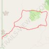
Alamao Canyon Loop in Valles Caldera National Preserve

United States > New Mexico > Sandoval County > Sulphur Springs

Distance: 19.1 Km • Elevation gain: 518 m • Maximum elevation: 2,871 m

Gear up for your next adventure:

🛶Kayak Accessories - Essential gear for safe and fun kayaking adventures
🧳Compression Sacks - Maximize space in your backpack by shrinking gear
🎒Hiking Backpack - Lightweight and ergonomic backpacks for day hikes or multi-day treks
🧊Portable Cooler - Keep food and drinks cold during outdoor adventures
🔥Camping Stove - Portable stoves to cook outdoors with ease

As an Amazon Associate, this site earns from qualifying purchases at no extra cost to you.