Import a GPX file

Nikšić Municipality trails

Click on a trail to view its statistics, map and profile.
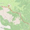
Lukavica - Velje Duboko - Mrtvica

Montenegro > Nikšić Municipality > Bojovića bare > Piperski katun

Distance: 30.4 Km • Elevation gain: 1,610 m • Maximum elevation: 1,806 m
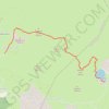
Kapetanovo jezero - Zagarački Katun - Ilijin i Nikolin Vrh

Montenegro > Nikšić Municipality > Bojovića bare > Piperski katun

Distance: 7.5 Km • Elevation gain: 486 m • Maximum elevation: 2,040 m

Other places

Gear up for your next adventure:

🚲Handlebar Phone Mount - View topographic-map.com live while cycling
🧭GPS Tracker - Track your location in remote areas safely
🥾Light Hiking Boots - Lightweight and comfortable boots for day hikes
🧊Insulated Water Bottle - Keeps drinks cold in summer and prevents freezing in winter
🧢Sun Protection Cap - Breathable cap to protect from sun exposure

As an Amazon Associate, this site earns from qualifying purchases at no extra cost to you.