Import a GPX file

Village of Tarrytown trails

Click on a trail to view its statistics, map and profile.
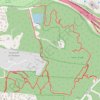
Taxter Ridge Loop Trails

United States > New York > Westchester County > Village of Tarrytown

Distance: 8.2 Km • Elevation gain: 186 m • Maximum elevation: 158 m
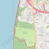
Westchester RiverWalk

United States > New York > Westchester County > Village of Tarrytown

Distance: 2.3 Km • Elevation gain: 90 m • Maximum elevation: 71 m

Gear up for your next adventure:

🎒Backpack Rain Cover - External shield to keep your entire pack dry
🚲Handlebar Phone Mount - View topographic-map.com live while cycling
🩹Compact First Aid Kit - Pre-packed essentials for common trail injuries
👟Trail Running Shoes - Agile footwear for fast-paced topographic exploration
🥾Lightweight Hiking Boots - Boots for comfort and mobility on long hikes

As an Amazon Associate, this site earns from qualifying purchases at no extra cost to you.