Import a GPX file

Madikeri taluku trails

Click on a trail to view its statistics, map and profile.
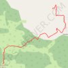
Tadiandamol

India > Karnataka > Madikeri taluku > Yavakapadi

#Hiking

Distance: 8.1 Km • Elevation gain: 847 m • Maximum elevation: 1,717 m

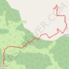
Tadiandamol

India > Karnataka > Madikeri taluku > Yavakapadi

Distance: 8.1 Km • Elevation gain: 847 m • Maximum elevation: 1,717 m
Other places

Gear up for your next adventure:

🥾Trail Running Shoes - Lightweight and durable shoes for trail running
🚑Survival Whistle - Signal for help across long distances in mountains
🎒Backpack Rain Cover - External shield to keep your entire pack dry
🗺️Topographic Maps - Detailed maps to explore trails, mountains, and wilderness areas
🪑Ultralight Camping Stool - Compact seating for rest stops during long hikes

As an Amazon Associate, this site earns from qualifying purchases at no extra cost to you.