Import a GPX file

Lakewood trails

Click on a trail to view its statistics, map and profile.
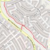
Trail from S Coors St to W Jewell Ave. "Loveland Trail"

United States > Colorado > Jefferson County > Lakewood

Distance: 1.1 Km • Elevation gain: 50 m • Maximum elevation: 1,836 m

Gear up for your next adventure:

🕯️Camping Lantern - Illuminates your entire campsite with high-efficiency LEDs
🥫Freeze-Dried Meals - Lightweight, high-calorie nutrition for multi-day treks
🚲MTB Frame Bag - Carry tools and maps directly on your bicycle frame
📷Outdoor Action Camera - Capture high-elevation views and rugged adventures
☕Camping Coffee Maker - Brew fresh coffee anywhere on the topographic map

As an Amazon Associate, this site earns from qualifying purchases at no extra cost to you.