Import a GPX file

Nottingham trails

Click on a trail to view its statistics, map and profile.
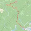
South Mount Pawtuckaway via Mountain Trail and South Ridge Trail

United States > New Hampshire > Rockingham County > Nottingham

Distance: 9.4 Km • Elevation gain: 252 m • Maximum elevation: 262 m
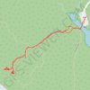
Blair Woods Trail

United States > New Hampshire > Rockingham County > Nottingham

Distance: 1.9 Km • Elevation gain: 28 m • Maximum elevation: 107 m

Gear up for your next adventure:

🥾Lightweight Hiking Shoes - Comfortable shoes for day hikes
🧭GPS Tracker - Track your location in remote areas safely
🚲Handlebar Phone Mount - View topographic-map.com live while cycling
🧥Waterproof Pants - Keep dry during rainy hiking conditions
🔦LED Headtorch - Bright and durable light for night activities

As an Amazon Associate, this site earns from qualifying purchases at no extra cost to you.