Import a GPX file

Crockham Hill trails

Click on a trail to view its statistics, map and profile.
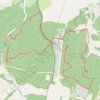
High Chart and Limpsfield National & SE League

United Kingdom > England > Kent > Sevenoaks > Crockham Hill

Distance: 8.9 Km • Elevation gain: 146 m • Maximum elevation: 214 m

Gear up for your next adventure:

☕Camping Coffee Maker - Brew fresh coffee anywhere on the topographic map
🗺️Topographic Maps - Detailed maps to explore trails, mountains, and wilderness areas
⛺Tent Footprint - Protect tent floor and increase durability
💧Collapsible Water Bottle - Space-saving water bottle for outdoor activities
🔋Lithium AA Batteries - Long-lasting power that performs in extreme cold

As an Amazon Associate, this site earns from qualifying purchases at no extra cost to you.