
Burlington trails
Click on a trail to view its statistics, map and profile.
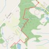
Bruce Trail from Guelph Line
Canada > Ontario > Halton Region > Burlington
Distance: 5.4 Km • Elevation gain: 119 m • Maximum elevation: 270 m
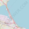
Burlington - Hamilton
Canada > Ontario > Halton Region > Burlington
Waterfront Trail. Lake Ontario. #Bike #Waterfront #Ontario
Distance: 12.1 Km • Elevation gain: 50 m • Maximum elevation: 82 m
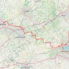
Aldershot - Kitchener
Canada > Ontario > Halton Region > Burlington
#Bike
Distance: 79.0 Km • Elevation gain: 570 m • Maximum elevation: 346 m