
West Greenwich trails
Click on a trail to view its statistics, map and profile.
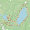
Carr's Pond and Tarbox Pond Loop Trail via Ring Road in Big River Management Area
United States > Rhode Island > Kent County > West Greenwich
The Carr's Pond and Tarbox Pond Loop Trail offers a peaceful escape into nature, featuring serene views of the ponds surrounded by lush forests and diverse wildlife. Hikers can enjoy a moderate challenge as they encounter picturesque spots, perfect for photography or simply soaking in the tranquil…
Distance: 6.6 Km • Elevation gain: 67 m • Maximum elevation: 120 m
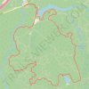
Big River Management Area loop
United States > Rhode Island > Kent County > West Greenwich
Distance: 11.7 Km • Elevation gain: 111 m • Maximum elevation: 116 m
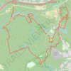
Big River trails
United States > Rhode Island > Kent County > West Greenwich
West Greenwich Trail Running
Distance: 26.5 Km • Elevation gain: 249 m • Maximum elevation: 121 m