Import a GPX file

Devola trails

Click on a trail to view its statistics, map and profile.
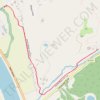
Devola Multi-Use Trail from end to Broughton trailhead

United States > Ohio > Washington County > Devola > Unionville

Distance: 1.7 Km • Elevation gain: 15 m • Maximum elevation: 193 m
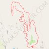
Orange Loop Trail

United States > Ohio > Washington County > Devola > Unionville

Distance: 4.9 Km • Elevation gain: 121 m • Maximum elevation: 277 m

Other places

Gear up for your next adventure:

🌬️Windproof Camp Stove - Efficient cooking even on exposed mountain peaks
🧴Outdoor Sunscreen - High SPF protection for high-altitude UV exposure
🪑Ultralight Camping Stool - Compact seating for rest stops during long hikes
🧥Softshell Hiking Jacket - The perfect balance of wind protection and breathability
🧥Ultralight Puffy Jacket - Maximum warmth that packs down to the size of an orange

As an Amazon Associate, this site earns from qualifying purchases at no extra cost to you.