Import a GPX file

Knodishall trails

Click on a trail to view its statistics, map and profile.
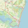
Suffolk Coast Path: Thorpeness to Aldeburgh

United Kingdom > England > Suffolk > East Suffolk > Knodishall

Distance: 21.8 Km • Elevation gain: 116 m • Maximum elevation: 24 m

Gear up for your next adventure:

👟Leg Gaiters - Keep debris, mud, and snow out of your boots
🧊Portable Cooler - Keep food and drinks cold during outdoor adventures
💧Collapsible Water Bottle - Space-saving water bottle for outdoor activities
🔦UV Flashlight - Detect minerals or specific insects in the dark
⛺Family Camping Tent - Spacious tent suitable for family camping trips

As an Amazon Associate, this site earns from qualifying purchases at no extra cost to you.