
Glendale trails
Click on a trail to view its statistics, map and profile.
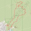
Brand Park Loop (Verdugo Mountains)
United States > California > Los Angeles County > Glendale
Starting near Brand Park, a foothill park at the base of the Verdugo Mountains, the loop leaves the landscaped edge of Glendale toward Brand Debris Basin, the Bamboo Ruins Trail, and the lower folds of Brand Canyon. The route then climbs Brand Motorway through chaparral-covered slopes and open switchbacks to…
Distance: 9.5 Km • Elevation gain: 790 m • Maximum elevation: 862 m
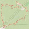
Mount Lukens Loop from Deukmejian Wilderness Park
United States > California > Los Angeles County > Glendale
Starting at Mount Lukens Trailhead in Deukmejian Wilderness Park, the route first leaves the Stone Barn area, crosses Dunsmore Creek on the lower park connector, and joins Crescenta View Trail before climbing through chaparral and sage scrub above Dunsmore Canyon toward The Redoubt. The ascent continues over…
Distance: 15.9 Km • Elevation gain: 1,065 m • Maximum elevation: 1,537 m

Glendale Peak and Mount Hollywood Loop via Riverside, Hogback, and Mount Hollywood Trails in Griffith Park
United States > California > Los Angeles County > Los Angeles
The Glendale Peak and Mount Hollywood Loop in Griffith Park offers hikers panoramic views of Los Angeles, including the Griffith Observatory, the Hollywood Sign, and the downtown skyline. The trail traverses diverse landscapes, from shaded paths to open ridges, providing a varied hiking experience. Along the…
Distance: 5.4 Km • Elevation gain: 273 m • Maximum elevation: 458 m
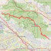
Verdugo Mountains Full Ridge
United States > California > Los Angeles County > Los Angeles
Hike on the Verdugo Mountains via Village Avenue Trail, La Tuna Peak, Chandler Mtrwy, Boy Scout Camp, Verdugo Motorway, Verdugo Crest Trail, Tree of Life, Wildhos Saddle, Verdugo Peak, Mesa Lila Road, Mount Thom and Las Flores Motorway. #Hiking #Mountain #Nature #Forest #Park
Distance: 23.3 Km • Elevation gain: 1,174 m • Maximum elevation: 946 m

Crescenta Valley Park Trail
United States > California > Los Angeles County > Glendale > Highway Highlands
Distance: 5.6 Km • Elevation gain: 361 m • Maximum elevation: 762 m


Teatown Lake Reservation: Overlook Trail, Hidden Valley Loop and Phenology Trail
United States > New York > Westchester County > Town of Yorktown > Glendale
Distance: 7.0 Km • Elevation gain: 157 m • Maximum elevation: 179 m

Whiting Woods
United States > California > Los Angeles County > Glendale
Distance: 4.7 Km • Elevation gain: 320 m • Maximum elevation: 695 m

Sinnington MTB loop
United Kingdom > England > North Yorkshire > Sinnington
Distance: 22.8 Km • Elevation gain: 464 m • Maximum elevation: 276 m

Griffith Manor Park
United States > California > Los Angeles County > Glendale
Distance: 2.0 Km • Elevation gain: 6 m • Maximum elevation: 152 m