Import a GPX file

Patishka Reka trails

Click on a trail to view its statistics, map and profile.
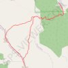
Patiška Reka-Milenkov kamen-Mirska voda-Patiska reka

North Macedonia > Patishka Reka

Distance: 14.6 Km • Elevation gain: 1,342 m • Maximum elevation: 2,202 m
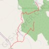
Milenkov Kamen (Karadzica)

North Macedonia > Patishka Reka

Distance: 10.4 Km • Elevation gain: 1,024 m • Maximum elevation: 2,200 m

Gear up for your next adventure:

🔦LED Headlamp - Hands-free lighting for early morning starts or late finishes
👟Sport Hiking Sandals - Breathable footwear for water crossings and camp rest
🧢Outdoor Cap - Protective cap for sun and rain during hikes
💡LED Headlamp - Hands-free illumination for night hiking and camping
⛺Camping Tent - Weather-resistant tents suitable for 2 to 6 people

As an Amazon Associate, this site earns from qualifying purchases at no extra cost to you.