Import a GPX file

Boone County trails

Click on a trail to view its statistics, map and profile.
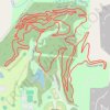
Rhett's Run MTB Trail in Cosmo Park

United States > Missouri > Boone County > Columbia

Distance: 8.4 Km • Elevation gain: 142 m • Maximum elevation: 227 m

Section of Katy Trail

United States > Missouri > Boone County > Rocheport

Distance: 34.0 Km • Elevation gain: 157 m • Maximum elevation: 191 m

Other places

 •

Gear up for your next adventure:

🚲MTB Frame Bag - Carry tools and maps directly on your bicycle frame
🪑Insulated Seat Pad - Protect your seat from cold rocks and wet logs
🕶️Polarized Sunglasses - Protect your eyes with durable polarized lenses
🥾Trail Running Shoes - Lightweight and durable shoes for trail running
🧤Insulated Winter Gloves - Heavy-duty protection for sub-zero Canadian adventures

As an Amazon Associate, this site earns from qualifying purchases at no extra cost to you.