Import a GPX file

Tumbler Ridge trails

Click on a trail to view its statistics, map and profile.
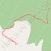
The Terminator Trail

Canada > British Columbia > Peace River Regional District > Tumbler Ridge

Distance: 5.9 Km • Elevation gain: 407 m • Maximum elevation: 1,953 m
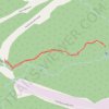
Babcock Falls Trail

Canada > British Columbia > Peace River Regional District > Tumbler Ridge

Distance: 1.9 Km • Elevation gain: 31 m • Maximum elevation: 1,328 m

Gear up for your next adventure:

🥾Trail Hiking Socks - Comfortable socks to prevent blisters and fatigue
🧢Hiking Sun Hat - Wide-brimmed protection for exposed mountain ridges
🧣Evaporative Cooling Towel - Beat the heat during intense summer climbs
🧥Ultralight Puffy Jacket - Maximum warmth that packs down to the size of an orange
🧴Insect Repellent - Protect yourself from bugs during outdoor adventures

As an Amazon Associate, this site earns from qualifying purchases at no extra cost to you.