Import a GPX file

Church End trails

Click on a trail to view its statistics, map and profile.
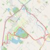
Frampton on Severn loop walk

United Kingdom > England > Gloucestershire > Stroud > Frampton on Severn > Church End

Distance: 14.0 Km • Elevation gain: 49 m • Maximum elevation: 21 m
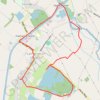
Frampton On Severn Loop Walk

United Kingdom > England > Gloucestershire > Stroud > Frampton on Severn > Church End

Distance: 7.2 Km • Elevation gain: 27 m • Maximum elevation: 21 m

Gear up for your next adventure:

🧤Rechargeable Heated Gloves - Extreme warmth for Canadian winter expeditions
🛶Waterproof Dry Bags - Keep electronics and clothes dry during river crossings
🥾Hiking Boots - Sturdy boots providing ankle support and traction on rugged trails
🧢Hiking Hat - Sun-protective and breathable hats for long treks
🥾Lightweight Hiking Shoes - Comfortable shoes for day hikes

As an Amazon Associate, this site earns from qualifying purchases at no extra cost to you.