Import a GPX file

Aillac trails

Click on a trail to view its statistics, map and profile.
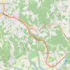
Voie Verte Périgord Quercy - De Aillac à Sarlat-la-Canéda

France > Nouvelle-Aquitaine > Dordogne > Carsac-Aillac > Aillac

Distance: 12.3 Km • Elevation gain: 186 m • Maximum elevation: 157 m

Gear up for your next adventure:

🧶550 Survival Paracord - Versatile utility cord for emergency repairs and rigging
🥾Hiking Gaiters - Protect legs and shoes from mud, snow, and debris
🏃Hydration Running Vest - Carry water and maps close to your body for speed
❄️Traction Ice Cleats - Slip-on spikes for icy trails and winter hiking
🧴Sunscreen SPF - Broad-spectrum sunscreen for outdoor activities

As an Amazon Associate, this site earns from qualifying purchases at no extra cost to you.