Import a GPX file

Hayfield trails

Click on a trail to view its statistics, map and profile.
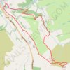
Mount Famine and South Head loop hike from Hayfield

United Kingdom > England > Derbyshire > High Peak > Hayfield

Distance: 9.1 Km • Elevation gain: 416 m • Maximum elevation: 489 m

Gear up for your next adventure:

🛰️Satellite Messenger - Emergency communication for areas with no cell service
🔪Outdoor Multitool - Versatile tool for repairs and food prep in the wild
🥾Waterproof Hiking Shoes - Durable shoes for wet and rugged trails
🥾Mountain Hiking Boots - High-traction boots for rocky terrain
🥫Freeze-Dried Meals - Lightweight, high-calorie nutrition for multi-day treks

As an Amazon Associate, this site earns from qualifying purchases at no extra cost to you.