Import a GPX file

Town of Boonville trails

Click on a trail to view its statistics, map and profile.
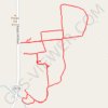
Most of the trails at Potato Hill farms

United States > New York > Oneida County > Town of Boonville

Distance: 6.9 Km • Elevation gain: 101 m • Maximum elevation: 417 m

Gear up for your next adventure:

☕Camping Coffee Maker - Brew fresh coffee anywhere on the topographic map
💧Hydration Bladder - Hands-free hydration solution for long treks
🦟Insect Repellent - Keep mosquitoes and black flies away in wooded areas
💡Portable Camping Lamp - Rechargeable lamp for campsite lighting
🛶Canoe Life Vest - Safety vest for water sports

As an Amazon Associate, this site earns from qualifying purchases at no extra cost to you.